
What to Do Between Ucluelet and Tofino
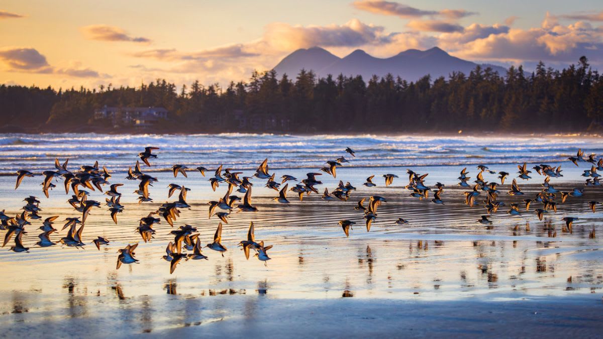
The drive between Ucluelet and Tofino is short, but it is one of the most scenic and activity-filled stretches on Vancouver Island’s west coast. The two towns are connected by Highway 4, with Pacific Rim National Park Reserve sitting between them.
You can drive from Ucluelet to Tofino in about 35 to 40 minutes without stopping, but that would miss the best part.
Between the two towns, you can walk through rainforest, surf at Long Beach, visit quiet beaches, explore tide pools, stop at viewpoints, paddle calm inlet water, watch storms, and enjoy some of the most famous coastal scenery in British Columbia.
This stretch is best explored slowly. Plan at least half a day if you want a few stops, or multi-day trips if you want to hike, surf, eat, and visit several beaches.
Top 10 Things to Do Between Ucluelet and Tofino
1. Walk the Wild Pacific Trail Lighthouse Loop in Ucluelet
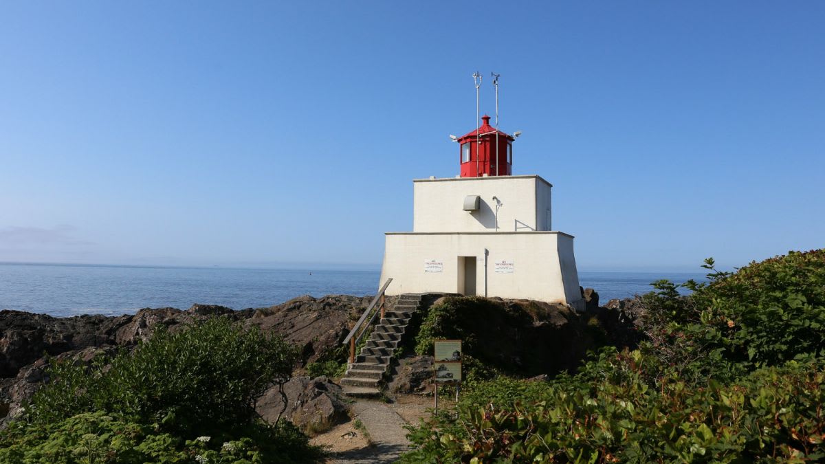
The Wild Pacific Trail is one of the best things to do before driving from Ucluelet to Tofino. It is not directly on Highway 4, but it is close enough that it should be part of any Ucluelet-to-Tofino day.
The trail follows the rugged edge of the Ucluelet Peninsula, with ocean views, rocky headlands, forest, benches, storm-watching decks, and views toward Barkley Sound.
The most popular section is the Lighthouse Loop, which passes near Amphitrite Point Lighthouse and gives visitors a quick but memorable look at the wild west coast.
This is a great first stop because it shows Ucluelet’s personality: quieter, rugged, dramatic, and less crowded than Tofino. It is also a good warm-up walk before spending the rest of the day on beaches and rainforest trails.
Key information and tips:
Best for: Ocean views, storm watching, easy walking, photography, first-time Ucluelet visitors.
Time needed: 30 minutes to 2 hours, depending on section.
Difficulty: Easy to moderate.
Best section for limited time: Lighthouse Loop.
Good to know: The trail is open year-round during daylight hours.
Planning tip: Walk the Lighthouse Loop in the morning, then continue toward Pacific Rim National Park Reserve.
Safety tip: Stay on the trail and off wave-washed rocks. The ocean can be dangerous during big surf.
2. Visit Florencia Bay
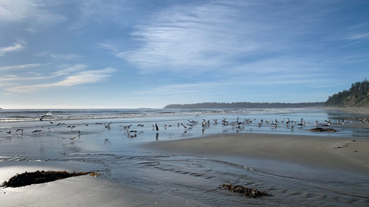
Florencia Bay, often called “Flo,” is one of the best beaches between Ucluelet and Tofino. It is located in Pacific Rim National Park Reserve and is closer to the Ucluelet side of the coast.
This beach is long, sandy, and backed by forest. It feels quieter than Long Beach and Cox Bay because visitors need to walk down a trail and wooden stairs to reach it. That extra effort makes the beach feel more hidden and peaceful.
Florencia Bay has both north and south access areas, and each one gives a slightly different experience.
Florencia Bay Beach North is accessed from the Florencia Bay North parking lot and is the better choice if you want the most direct access to the wide sandy beach. This side is good for long walks, photography, beachcombing, watching surfers, and seeing the broad open shoreline.
Florencia Bay South is reached from the Willowbrae Trail area. This route also connects toward Halfmoon Bay, so it is better if you want a forest-and-beach walk rather than a simple beach stop.
The south side can feel quieter and more tucked away, with forested trail sections, stairs, coastal views, and access toward the southern end of Florencia Bay. The beach access here may be steeper, rougher, or affected by erosion and driftwood, so check current conditions before visiting.
Florencia Bay is not the best swimming beach because the water is cold and surf conditions can be powerful.
Key information and tips:
Best for: Quiet beach walks, surfing, photography, wild coastal scenery, fewer crowds.
Time needed: 1 to 2 hours; longer if combining Florencia Bay South with Halfmoon Bay.
Difficulty: Easy to moderate, with stairs. South access may feel steeper, rougher, or more eroded depending on conditions.
Access: Florencia Bay Beach North is accessed from the Florencia Bay North parking lot. Florencia Bay South is accessed from the Willowbrae Trail area.
Good to know: Choose north access for the easiest beach-focused visit. Choose south access if you want a trail-based visit with the option to continue toward Halfmoon Bay.
Planning tip: Bring water, snacks, and layers before walking down to the beach. If using the south access, be ready for stairs, erosion, and driftwood.
Safety tip: Watch for rip currents, strong waves, changing tides, slippery stairs, erosion, and driftwood.
3. Find the Quieter Coast at Halfmoon Bay
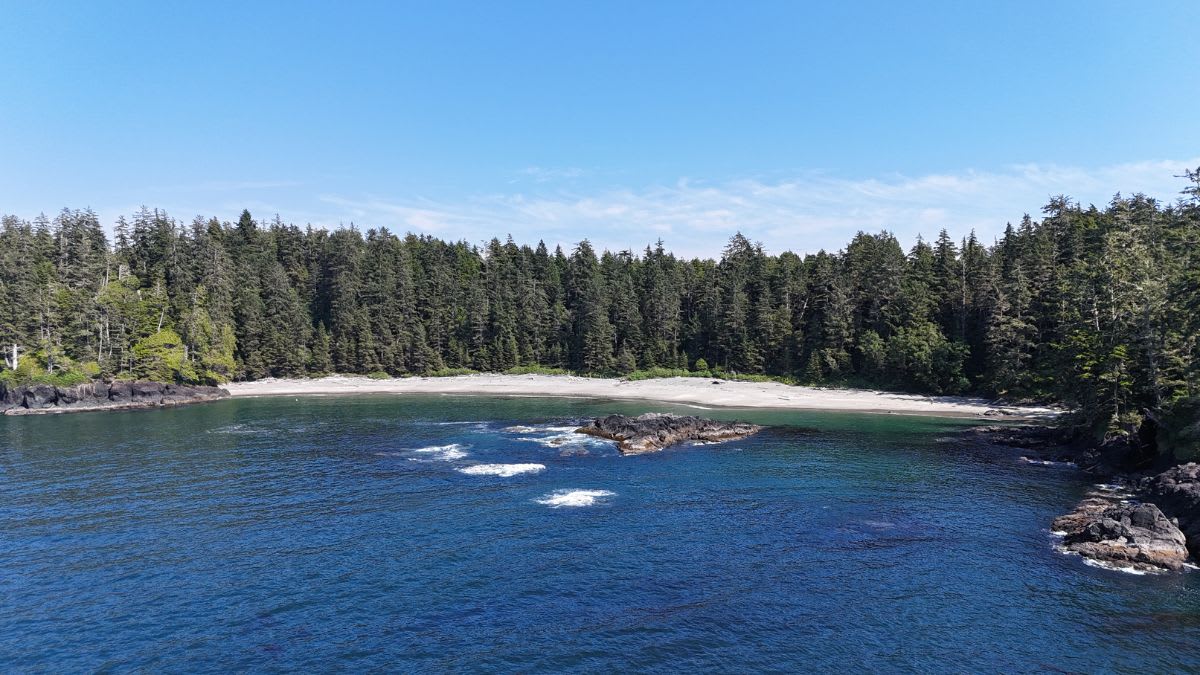
Halfmoon Bay is a smaller, quieter beach in Pacific Rim National Park Reserve. It is a good stop if you want a short forest walk and a hidden-feeling beach without the crowds of the larger beaches.
This beach is best for visitors who like quieter places. It is not a major surf beach or a big family beach day destination. Instead, it offers a tucked-away feel, coastal views, forest, and a more peaceful mood.
Halfmoon Bay is worth adding if you have already seen Long Beach or want a break from busier stops.
Key information and tips:
Best for: Quiet beach time, short hike, forest-and-beach experience, photography.
Time needed: 45 minutes to 1.5 hours.
Difficulty: Easy to moderate.
Good to know: The beach feels more hidden because it takes a little effort to reach.
Planning tip: Wear proper shoes, especially after rain.
Safety tip: Check tides and avoid slippery rocks or rough water.
4. Walk Chesterman Beach
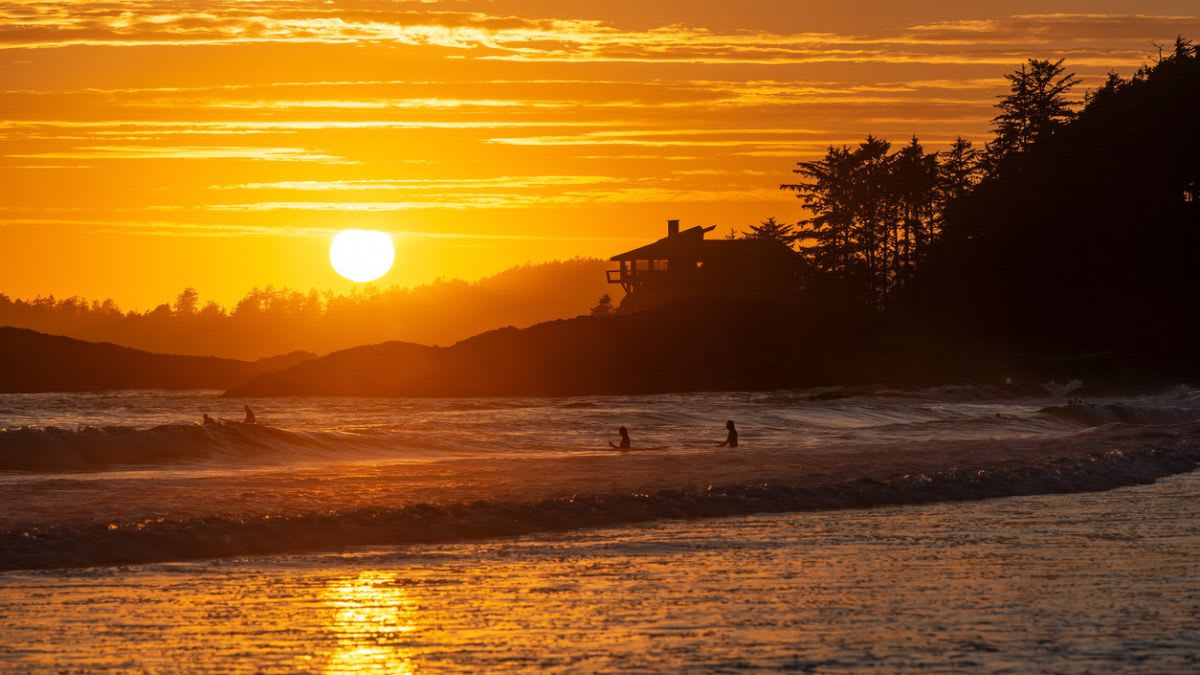
Chesterman Beach is one of the best beaches in Tofino and a great major beach stop. It is famous for long walks, surfing, sunsets, tide pools, and Frank Island at low tide.
Chesterman is a good all-around beach because it works for many visitors.
Surfers can get in the water when conditions are right. Families can walk and play in the sand. Photographers can visit at sunset. Couples can take a long beach walk.
At low tide, the tombolo toward Frank Island becomes walkable, but visitors need to watch the tide carefully.
Key information and tips:
Best for: Best all-around Tofino beach, sunsets, surfing, long walks, tide pools.
Time needed: 1 hour to half day.
Difficulty: Easy beach walking.
Good to know: Walk the tombolo on Chesterman Beach at low tide.
Planning tip: Save Chesterman for late afternoon or sunset if staying in Tofino.
Safety tip: Do not get cut off near Frank Island when the tide rises.
5. Spend Time at Long Beach
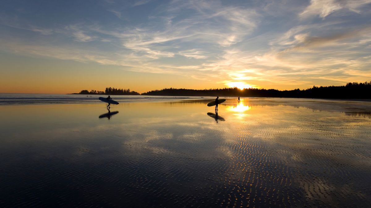
Long Beach is the most famous beach between Ucluelet and Tofino and one of the most iconic beaches on Vancouver Island. It is part of Pacific Rim National Park Reserve and stretches along the coast between the two towns.
This is the classic west coast beach: long sand, rolling surf, driftwood, old-growth forest, wide sky, and offshore rocks.
Long Beach stretches over 16 kilometres, making it the longest beach on the west coast of Vancouver Island. It is also known for Incinerator and Lovekin Rocks near the water’s edge.
Long Beach is excellent for walking, surfing, photography, storm watching, and first-time Pacific Rim visits. It is one of the best places to stop if you only have time for one beach between Ucluelet and Tofino.
Key information and tips:
Best for: Classic Pacific Rim scenery, surfing, long walks, storm watching, photography.
Time needed: 1 hour to half day.
Difficulty: Easy beach access, but conditions matter.
Good to know: Pacific Rim National Park Reserve’s Long Beach Unit is open year-round.
Planning tip: Visit at low tide for the widest walking area.
Safety tip: The Pacific Ocean is cold and powerful. Watch for rip currents, large waves, tides, and rolling drift logs.
6. Walk the Wild Pacific Trail Artists Loop
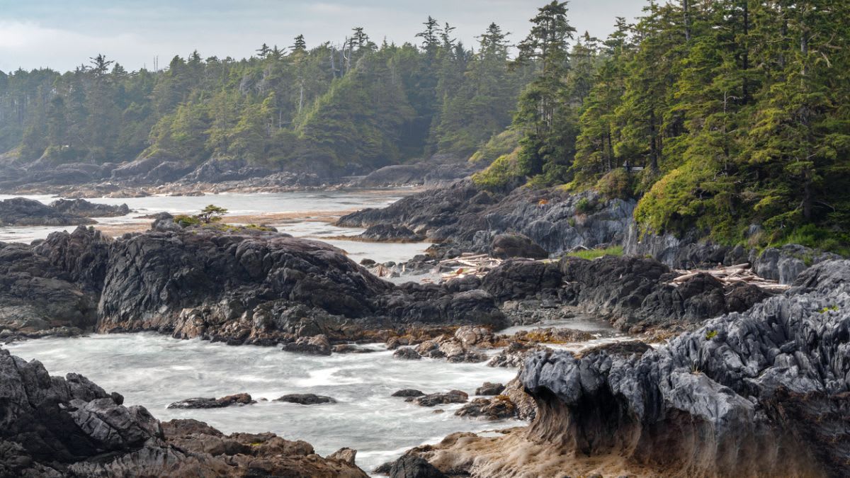
The Wild Pacific Trail Artists Loop is one of the most scenic sections of the Wild Pacific Trail in Ucluelet. It branches off the Brown’s Beach section and brings walkers closer to the shoreline, ocean swells, rocky headlands, and dramatic west coast viewpoints.
This section is called the Artists Loop for a reason. It has the kind of views that make people stop often: waves hitting black rocks, forest meeting the sea, changing light over the Pacific, and benches or viewpoints that feel made for sketching, painting, photography, or quiet reflection.
Compared with the Lighthouse Loop, the Artists Loop can feel a little more rugged and intimate.
The Lighthouse Loop is the classic first-time Ucluelet walk, while the Artists Loop is better if you want a quieter coastal section with dramatic cliff-side views and a stronger hidden viewpoint feeling.
The trail also gives visitors a good mix of rainforest and open ocean scenery. You can follow the coastline for the best views, or take a rainforest route if you want a calmer forest walk.
At the end of the Artists Loop section, the trail continues toward other Wild Pacific Trail areas, including the Ancient Cedars and Rocky Bluffs sections.
Key information and tips:
Best for: Ocean viewpoints, photography, sketching, storm watching, coastal walking, rainforest scenery.
Time needed: 30 minutes to 1.5 hours, depending on how many viewpoints you stop at and whether you connect to other trail sections.
Difficulty: Easy to moderate. The main trail is walkable for most visitors, but some sections may include uneven ground, stairs, roots, or wet surfaces.
Access: The Artists Loop branches off the Brown’s Beach section of the Wild Pacific Trail.
Planning tip: Visit when you have time to stop often. This is not a trail to rush because the viewpoints are the main reward.
Photography tip: Morning and late afternoon light can be beautiful, but stormy weather can also create dramatic wave photos from safe viewpoints.
Safety tip: Stay on the marked trail and viewing areas. Do not go onto wet rocks or cliff edges, and watch for large waves even when you think you are a safe distance from the ocean.
7. Visit Big Beach
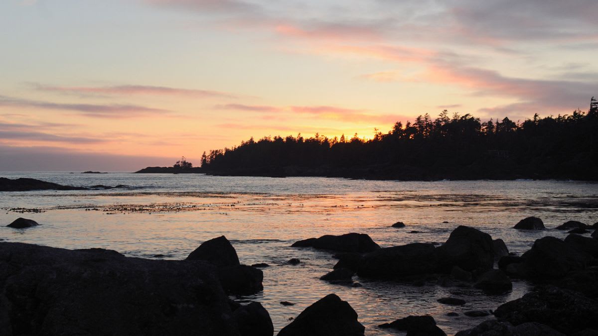
Big Beach is one of the easiest beaches to visit in Ucluelet and a great stop if you want a quick taste of the wild west coast. It has a mix of sand, rocks, driftwood, tide pools, open ocean views, and the remains of the Big Beach Mystery Shipwreck nearby.
This beach is best for short walks, sunset photos, beachcombing, and exploring tide pools at low tide. The old shipwreck adds a small historic point of interest, making Big Beach feel a little different from other quick beach stops in town.
Key information and tips:
Best for: Tide pools, sunsets, beachcombing, short visits, easy access.
Time needed: 30 minutes to 1 hour.
Difficulty: Easy.
Good to know: Visit at low tide if you want to see tide pools.
Planning tip: Pair Big Beach with the Wild Pacific Trail for an easy Ucluelet outing.
Safety tip: Rocks can be slippery, waves can be unpredictable, and old wreckage may be unstable. Look, but do not climb on or disturb the shipwreck.
8. Surf or Watch Waves at Cox Bay
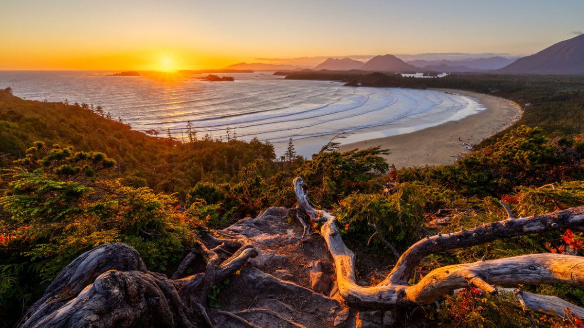
Cox Bay is closer to Tofino, but it is one of the best stops to include near the end of a Ucluelet-to-Tofino day.
It is one of Tofino’s top surf beaches and is known for consistent surf, wide sand, tide pools at both ends, and winter storm watching.
Cox Bay is home to most Tofino surf competitions. That makes it a great place to watch surfers even if you do not plan to surf yourself.
Cox Bay is also a good beach for photography, wave watching, and long walks. It feels more energetic and exposed than calmer beaches like Mackenzie/tinwis.
Key information and tips:
Best for: Surfing, surf watching, storm watching, beach walks, photography.
Time needed: 1 hour to half day.
Difficulty: Easy beach access, but ocean conditions can be serious.
Good to know: Several resorts and campgrounds sit near Cox Bay.
Planning tip: Book surf lessons ahead if you want to learn.
Safety tip: Watch for rip currents, cold water, and rolling drift logs.
9. Explore Tofino Hot Springs Cove
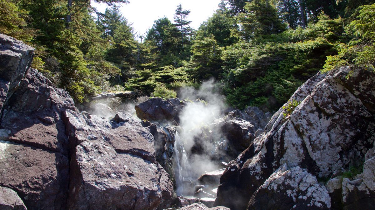
Tofino Hot Springs Cove is one of the most unique day trips from Tofino. It is not a roadside stop or a regular beach visit.
The hot springs are located in Nism̓aakqin Park, formerly known as Maquinna Marine Park, in Ahousaht territory, and they are reached by boat or floatplane.
The experience usually includes a scenic trip through Clayoquot Sound, followed by a forest boardwalk walk to the hot springs area.
The pools sit beside the ocean, where hot spring water flows over rock and mixes with cooler sea water. It is a special place, but it should be treated with respect because it is culturally important and environmentally sensitive.
Key information and tips:
Best for: A special Tofino day trip, hot springs, scenery, rainforest, boat or floatplane adventure.
Time needed: Usually a half-day or longer, depending on tour type.
Difficulty: Easy to moderate; you need to walk the boardwalk and manage wet, rocky areas near the pools.
Access: By boat or floatplane from Tofino.
Good to know: Tour operators may charge park-related fees and an Ahousaht Stewardship Fee.
Planning tip: Book ahead, especially in summer. Check current access, fees, and tour availability before going.
Safety tip: Rocks near the pools can be slippery. Follow all posted rules, respect cultural guidance, and avoid overcrowding the pools.
10. Hike Mount Ozzard
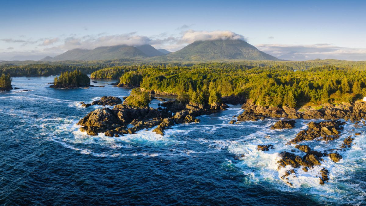
Mount Ozzard is a challenging hike near Ucluelet for visitors who want a harder inland adventure away from the beaches. It is best known for the radar dome at the top and wide views over Ucluelet, Barkley Sound, the Broken Group Islands, and the surrounding west coast.
This is not a casual sightseeing walk like the Wild Pacific Trail. Depending on the route, hikers may use a steep summit trail, mountain bike trail sections, or a longer service-road approach.
The hike can be muddy, rooty, steep, and confusing in places, so it is best for fit, confident hikers with navigation skills.
Mount Ozzard is worth considering if you have already explored the beaches and want a more serious hike with elevation, forest, and a big viewpoint reward.
Key information and tips:
Best for: Serious hikers, fitness challenge, summit views, Ucluelet scenery, less touristy trails.
Time needed: Allow several hours, depending on route and conditions.
Difficulty: Hard if using the summit trail; moderate to hard by service road because of length and steady climbing.
Access: Near Ucluelet; check current trail access before going.
Good to know: This area also has mountain biking trails, so stay alert and yield where needed.
Planning tip: Download an offline map before you start. Do not rely on cell service or vague directions.
Safety tip: Bring proper hiking shoes, water, snacks, rain gear, and navigation. Avoid this hike in poor weather, low visibility, or if you are not comfortable with steep, muddy, or rough trails.
Final Thoughts
The stretch between Ucluelet and Tofino is more than a short drive. It is the heart of the Pacific Rim experience.
For the best route, do not rush. Choose a few stops that match your travel style.
To make the trip even more relaxing, pair your days of exploring with a stay in one of our wood cabins, complete with private saunas and cold plunges, and enjoy the Pacific Rim at a slower pace.